- he population of Haryana state is 25,351,462.
- The density of Haryana state is 573 per sq km.
- Haryana State is spread over 44,212 Sq Km.

Districts[edit]
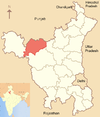
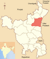
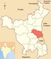
Government of Haryana has divided Haryana state in the following 22 districts:
| District | Code[4][5] | Headquarters | Established | Area (in km²) | Population (As of 2012)[6] | Map |
|---|---|---|---|---|---|---|
| Ambala | AM | Ambala | 1 November 1966 | 1,574 | 1,136,784 |  |
| Bhiwani | BH | Bhiwani | 22 December 1972 | 4,778 | 1,629,109 |  |
| Faridabad | FR | Faridabad | 2 August 1979 | 1,792 | 1,798,954 |  |
| Fatehabad | FT | Fatehabad | 15 July 1997 | 2,538 | 941,522 |  |
| Gurgaon | GU | Gurgaon | 1 November 1966 | 1,253 | 1,514,085 |  |
| Hisar | HI | Hisar | 1 November 1966 | 3,983 | 1,742,815 |  |
| Jhajjar | JH | Jhajjar | 15 July 1997 | 1,834 | 956,907 |  |
| Jind | JI | Jind | 1 November 1966 | 2,702 | 1,332,042 |  |
| Kaithal | KT | Kaithal | 1 November 1989 | 2,317 | 1,072,861 |  |
| Karnal | KR | Karnal | 1 November 1966 | 2,520 | 1,506,323 |  |
| Kurukshetra | KU | Kurukshetra | 23 January 1973 | 1,530 | 964,231 |  |
| Mahendragarh | MH | Narnaul | 1 November 1966 | 1,859 | 921,680 |  |
| Mewat | MW | Nuh | 4 April 2005 | 1,874 | 1,089,406 |  |
| Palwal | PL | Palwal | 15 August 2008 | 1,359 | 1,040,493 |  |
| Panchkula | PK | Panchkula | 15 August 1995 | 898 | 558,890 |  |
| Panipat | PP | Panipat | 1 November 1989 | 1,268 | 1,202,811 |  |
| Rewari | RE | Rewari | 1 November 1989 | 1,582 | 896,129 |  |
| Rohtak | RO | Rohtak | 1 November 1966 | 1,745 | 1,058,683 |  |
| Sirsa | SI | Sirsa | 26 August 1975 | 4,277 | 1,295,114 |  |
| Sonipat | SO | Sonipat | 22 December 1972 | 2,122 | 1,480,080 |  |
| Yamuna Nagar | YN | Yamunanagar | 1 November 1989 | 1,768 | 1,214,162 |  |
|CHARKHI DADRI |AM |CHARKHI DADRI Charkhi Dadri is the 22nd district of Haryana State.

No comments:
Post a Comment
thanks for your valuable comment